Kyrgyzstan and Tajikistan 2018
Kyrgyzstan and Tajikistan 2018
Kyrgyzstan and Tajikistan
2018
This is not my first to either Kyrgyzstan or Tajikistan. I visited Kyrgyzstan with my youngest son, Andrew, in July 2006, concentrating on the capital city (Bishkek) and the fascinating area around Lake Issyk-Kul in the country’s north-east. My visit to Tajikistan was more recent – March 2017 to be precise – when I visited the western and northern parts of the country during the Nowruz (Persian New Year) festivities. Descriptions of these trips can be seen by following the following links: Kyrgyzstan and Tajikistan.
This trip was to be quite different. Intended to collect material for some books I am writing, this trip is designed to take me to less commonly visited areas that I have not previously visited – the area around Osh in western Kyrgyzstan, then to the south-east of Kyrgyzstan and into Tajikistan, following the road through the Pamir Mountains along the eastern and southern border regions of the country. (By the way, have you noticed that when you spell Kyrgyzstan, you have to plough through nine letters to reach a vowel?).
Planning for this trip had been arduous and frustrating, with frequent changes to schedules and incessant bureaucracy to overcome. And so it was with a sense of relief that I landed this morning in Osh, an hour minutes late at 7:30am, on my S7 Airlines Boeing 737 from Moscow.
There are very few options to get to Osh, even though it is Kyrgyzstan’s second largest city. Indeed, it isn’t even very easy to get to the nation’s capital city, Bishkek. Although the choice of flying into Osh through Moscow was based on pragmatism (I could get a flight using points), there was something symbolic about entering this former Soviet outpost from the city that once dominated – indeed, totally controlled – Kyrgyzstan and the rest of Central Asia.
The relief of arriving was short-lived when I realised that my luggage had not arrived with me. Presumably it is held up on one of my intermediate stops (Dubai or Moscow), and it didn’t help that the clerk who records lost luggage spoke almost no English – just enough to say “wait eight or twelve days”. And so I’m here in Central Asia with nothing to wear but the clothes I was wearing on my flight (not ideal in temperatures reaching the high thirties), no medications, and not much hope of receiving my luggage before I leave Osh this Sunday morning.
I was the last passenger on my flight to leave the airport terminal, and my driver (arranged online several months ago) was just about to leave without me. I would tell you his name, but his English was too limited to do introductions. He apparently learnt English at school twenty years ago, and was clearly not very proficient at it, but he knew where to take me so travel worked well – although I’m sure he must have been wondering why I was travelling with so little luggage.
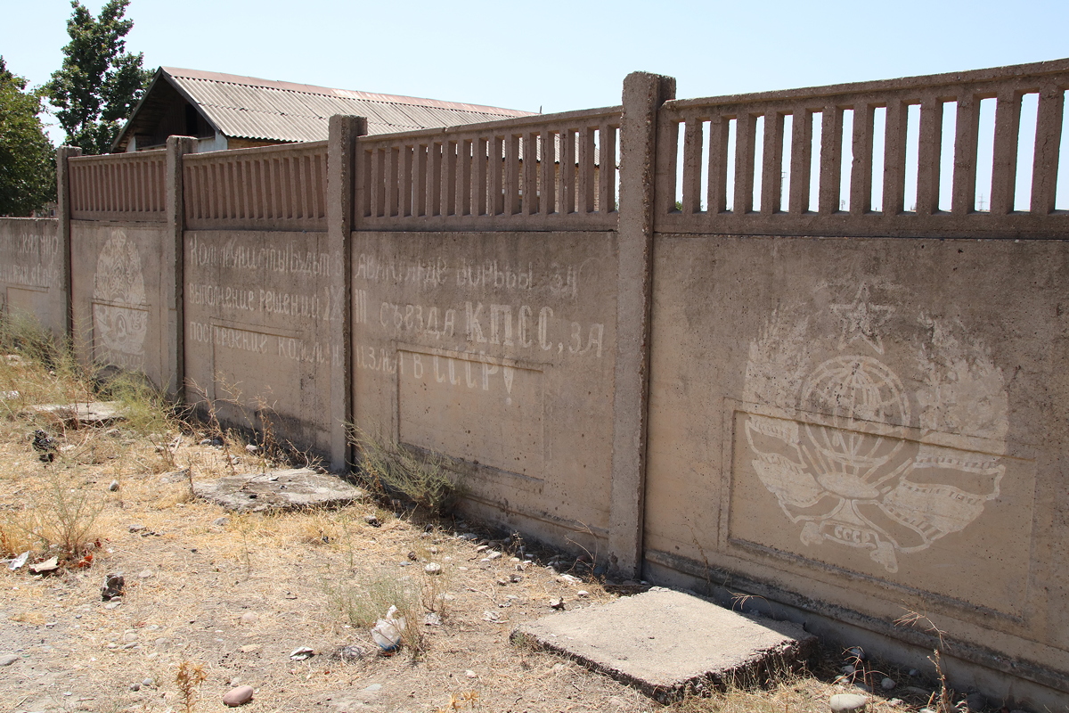
Situated just five kilometres from Kyrgyzstan’s western border with Uzbekistan, Osh is the oldest city in Kyrgyzstan, and claims a history of over 3,000 years. It has a population today of about 260,000 people, comprising a diverse mix of Kyrgyz, Uzbeks, Russians and Tajiks. I needed to get local money (som) from an ATM, so I got my first glimpse of Osh on the way to the bank. My initial impression is that Osh is a singularly unremarkable city – indeed, it is remarkable for the extent of its unremarkable qualities.
However, exploring Osh could wait until Saturday – my focus today and tomorrow is not the city itself, but the surrounding region. Specifically, I had come to study the water-energy-food nexus around Osh. This meant my intention was to visit dams, irrigation systems, farms and power stations (which I readily acknowledge is not everyone’s idea of great sightseeing). I won’t go into the detailed geography of these interactions here in this trip diary, but rather I’ll describe the travel I undertook to investigate it.
Travelling for a full day is probably not a great idea when you have had no sleep as a result of being on a four-hour overnight flight from 12:30am to 7:30am. Nonetheless, for better or worse, that was my plan, and that’s what I did – and I managed to stay awake for the whole day (just!).
The drive from Osh to Toktogul was about 400 kilometres, snaking around the border with Uzbekistan which twists and turns alarmingly. The first third of the trip was only mildly interesting as the land was flat and the farming was mostly obscured from view by ramshackle shops and houses, interspersed with long grass, shrubs and trees alongside the road. There were glimpses of crops to be seen, mainly corn, but very little that I deemed to be ‘photo-worthy’.
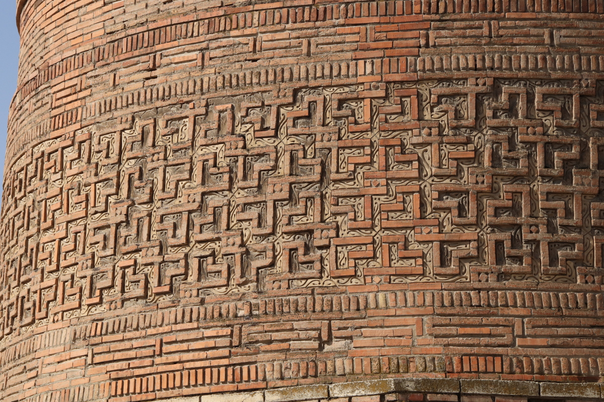
After a couple of hours, just before the town of Uzgen, we crossed a large river known as the Kara Darya (which means Black River). Like several other rivers we crossed, the Kara Darya had a wide boulder-strewn bed, but unlike the other rivers, it also had a respectable flow of water. The Kara Darya marked the beginning of progressively more interesting scenery. Just beyond the Kara Darya, the town of Uzgen boasted a tall brick tower dating from the 11th-12th centuries, a noteworthy landmark that is featured on Kyrgyzstan’s 50 som banknote.
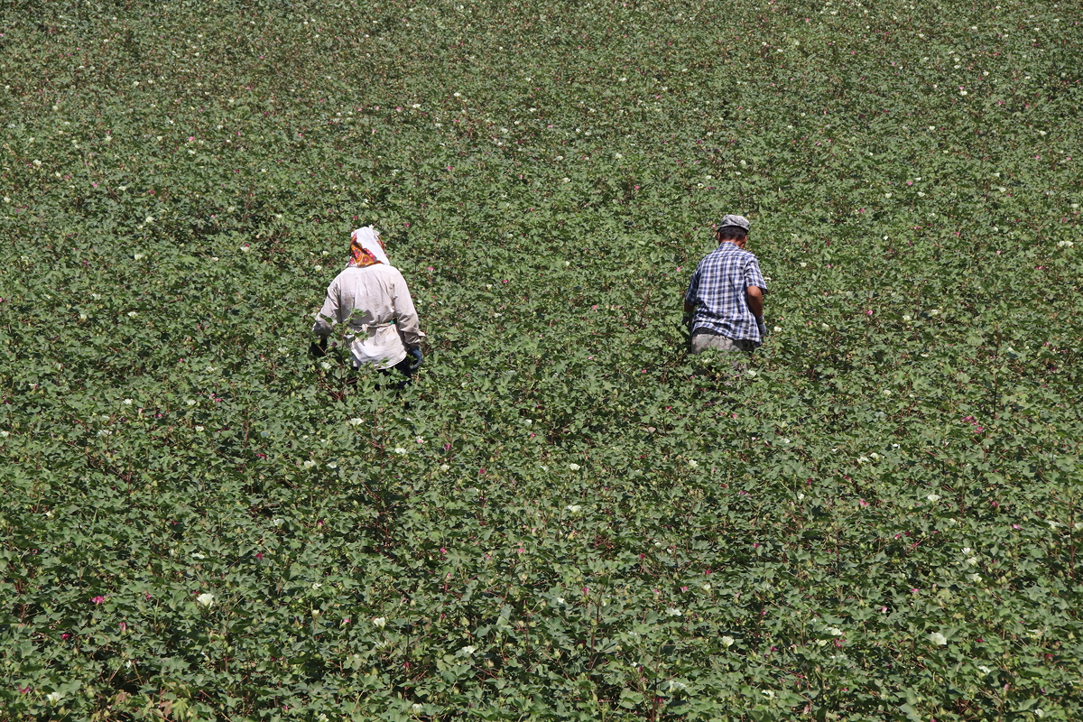
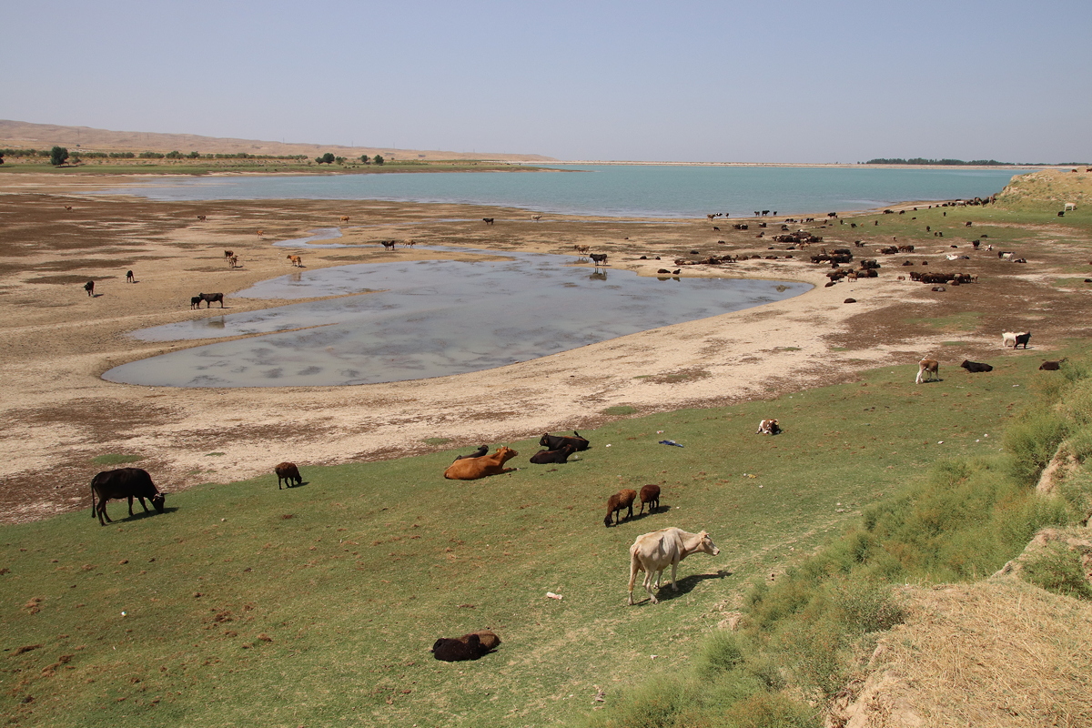
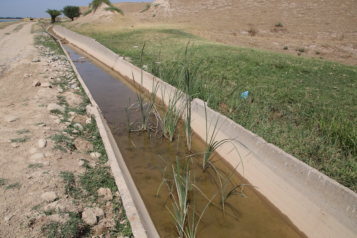
Just before the town of Akman, the banks of a large water reservoir to the left (south) of the road were hosting a large herd of cattle. Nearby were some of the best Soviet-era concrete irrigation canals I have seen in Central Asia, still functioning and not as decrepit as many others have now become. A little further along the road, extensive irrigated cotton fields were being tended in a labour-intensive manner by small teams of workers.
In many places, the Kyrgyz-Uzbek border came very close to the road, but nowhere was this more evident than a four-kilometre long stretch of highway just south of Dostuk. On this stretch of road, the border was marked by a large, multi-strand barbed wire fence that ran right along the edge of the road, mirrored by a parallel fence about twenty metres further west and separated by a ‘no-man’s land’ zone in between, punctuated occasionally by watchtowers housing heavily armed soldiers wearing camouflage fatigues.
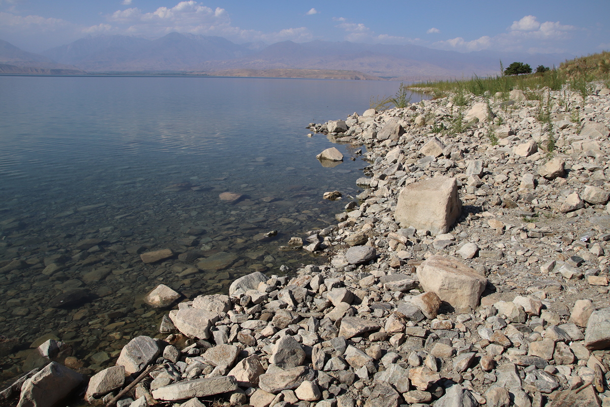
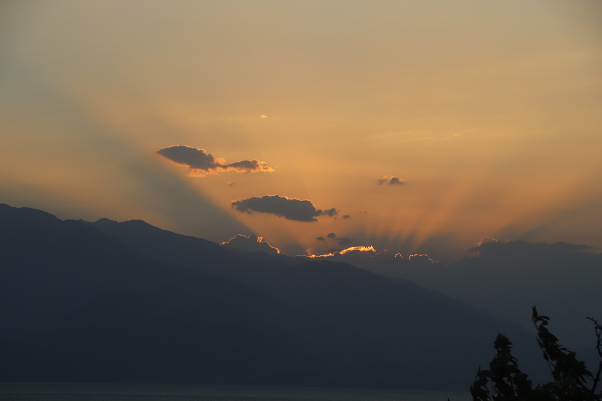
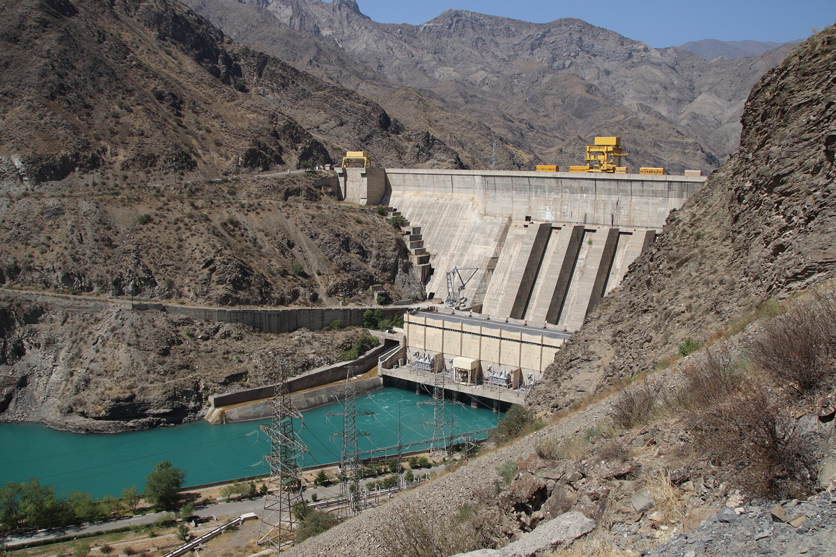
A little further to the north, the scenery became truly dramatic and the road entered the deep canyon of the Naryn Darya (Naryn River). During the Soviet era, a series of dams were built in close proximity to one another to generate hydro-electric power and it was fascinating to veer off the main road to see each one of them – the Shamaldy-Say Dam, the Tash-Komur Dam, the Tash-Komul Dam, and the Kara-Kul Dam. The road to the dam that forms the biggest lake on the Naryn, the Toktogul Reservoir, was closed for security reasons, but my guesthouse accommodation for the night was situated overlooking the southern shore of the lake, offering a splendid panorama as the sun set at the conclusion of a long, enjoyable but sadly luggage-free day.

Day 1
Osh to Toktogul
Thursday
16 August 2018